Aberbechan Hall, near Newtown, Powys in 1796 (Source: John Ingleby, Wikipedia)
This post is the final instalment (for now) of a trilogy which began with identification of the location of a Tudor royal horse stud at ‘Eskermayne,‘ otherwise known as The Park, Park Penprise (plus variants) or Llys Pen Prys to the west of Caersws. The second instalment considered the broader historical context for horse breeding in Late Medieval and Early Modern Mid Wales, given that another major royal equestrian enterprise was probably located in Montgomeryshire (now North Powys) during the Tudor period. However, it is possible the latter (with stock numbers several times larger than Eskermayne – see discussion below) extended over more than one site forming, along with the Caersws operation, a strategic cluster Work by the historian Professor Maria Hayward of Southampton University (eg The 1542 Inventory of Whitehall: the palace and its keeper, vols 1 & 2 (Society of Antiquaries of London, 2004)), refers to: “Stud at Eskermayne, Wales Thomas Guilliam – in office in 1547… Stud in Wales Rice ap Moris – in office in 1547,” which seems to clearly link named keepers to the respective horse breeding operations. Whilst the identity of Guilliam has not been immediately accessible, it seems reasonable to deduce that Rice ap Moris refers to Rhys Ap Morris Blayney (1493 – 1568) who became High Sherriff of Montgomeryshire. He is linked to Aberbechan Hall (shown above) so the unknown stud location might have been in this vicinity, possibly extending to other sites in North Powys, a configuration that conforms with the Royal Armouries map discussed previously. In recent years, incidentally, Aberbechan has become associated with the family of well-know show jumper and sports horse producer Roland Fernyhough.
Further Discussion
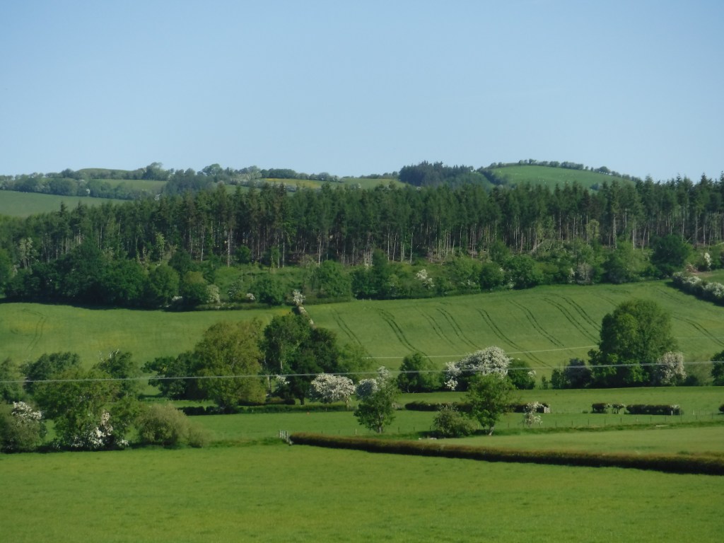
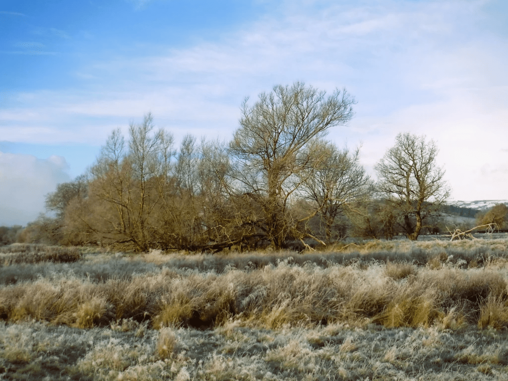
Coed Y Park (or Park Wood) in late May 2023 viewed from the South (Picture: Janet Mackinnon)
In The History of the Countryside, the late Oliver Rackham notes that: “A disused park might revert to being a wood, often permanently acquiring the name ‘Park Wood’ (Chapter 6: Wood-pasture – Wooded commons, parks and wooded forests). Unfortunately, in this instance the mighty oaks described by writers of the Tudor period have been replaced by modern plantation, although some remnant of ancient woodland survives nearby and is discussed later. The entry for Caersws Park in the regional Historic Environment Record (HER) confirms this is a scheduled park and “was part of the Earl of Leicester’s holdings in the later 16th century” (thanks to Dr Gary Duckers of the Clwyd-Powys Archaeological Trust (CPAT) for the HER material). More information about the Robert Dudley landholding can be found in an archive compiled by Dr Robin Darwall-Smith of University College Oxford, including details of the ‘The Park and Eskermayne Estates.’ A very helpful email exchange with Professor Robert Liddiard of the Medieval Warhorse project confirms the probability that the Park and Eskermayne studs were one and the same, based on various accounts for stock numbers of around 100 (or, more precisely, 97 mares, 11 fillies, and 4 colts for Eskermayne in 1547). Investigation in to the possible larger Tudor royal equestrian project in Montgomeryshire has not to date been so fruitful, but Professor Liddiard provided ‘Wales’ stock numbers (so the responsibility of Professor Hayward’s keeper ‘Rice ab Moris’ for 1547) as: 12 stallions; 266 mares; 111 fillies; 98 colts. Hopefully, this strategic cluster might be the subject of further research.
Returning to Eskermayne or the Park at Caersws, is is perhaps surprising that the important Tudor equestrian connection is not more widely known locally, along with the site’s significant medieval history. Anyone who has visited the area will know that this still holds some of the numinosity associated with more famous and better conserved wood pasture landscapes of the kind explored by Oliver Rackham; and the Caersws Basin setting at the confluence of the Rivers Severn, Carno and Trannon is quite striking. CPAT’s 2015 scheduling enhancement programme describes the Park thus:
Two kilometres to the west of Caersws, and only a short distance to the north of the road that ran westwards from the Roman fort, Penprys lies immediately above the plain of the River Severn (about 1.5km to the east) where a small stream, the Colwyn Brook, drops to the valley. It thus has all the topographical hallmarks of a carefully selected location.…
The listing includes a discussion of the significance of Park (Llys Pen Prys) during the Medieval period:
Melville Richards suggested this as the original centre for Arwystli, with Talgarth becoming important only at a later date, while to Sir John Lloyd Caersws was the royal manor or court of Arwystli Is Coed (Arwystli below the Wood) No other references to the significance of this site have been encountered, but David Stephenson seems confident that this was the site of a court, but that it was much the younger of the two. Pen-prys (or Pen Prys) first appears in the 1293 Inquisition Post Mortem of Owain ap Gruffudd ap Gwenwynwyn. It was at that date the manorial centre of Arwystli is Coed and was thus the administrative centre of that commote. It is probable that Arwystli was not divided into commotes until the 13th century – possibly c.1216, having been previously a single cantref/kingdom with a single administrative officer. But in a record of c.1216 when the territory had been seized by Llywelyn ab Iorwerth of Gwynedd, it is noted that he had two stewards of Arwystli, and Stephenson believes that this was when Talgarth became the court/centre for Arwystli uwch Coed, and Pen Prys the court/centre for Arwystli is Coed….
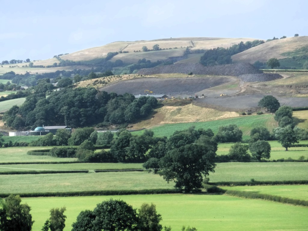
However, the listing concludes that: “In material terms …. nothing of historic interest has come to the attention of the archaeological records.” This may account for the fact that a somewhat weak Heritage Impact Assessment for the major expansion of a nearby intensive poultry unit operation (shown below) appeared to go unchallenged. Planning consent was granted in 2022 despite considerable opposition to this type of development, which has led to the modern county of Powys being labelled ‘the poultry capital of Wales.’ It is to be hoped that a current review 12 IPU applications by the Welsh government will lead to a more sustainable planning regime and that potential impacts of such facilities on the natural and historic environment will be given more weight in the future by the relevant statutory authorities.
Intensive poultry unit development near Coed Y Park, showing remnants of semi-ancient woodland, July 2023 (Janet Mackinnon)
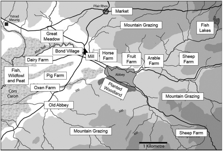
Late Medieval Abbey Farms of Strata Florida (Image source: UWTSD and Generalship website)
In his recent book Sarn Helen: A Journey Through Wales, Past, Present and Future, Tom Bullough walks an old Roman way between North and South Wales to reflect on the state of the nation and, especially, its “skeletal landscape” during an era of global nature decline and climate change, or as the Guardian put it “environmental end times.” Despite his own Welsh hill farming background, Bullough expresses particular concern about a tendency for sheep monoculture in Mid Wales, and it therefore seems a good time to reflect on ‘man-made’ landscape history in the present day counties of Powys and Ceredigion. This post will focus on the Late Medieval and Early Modern periods and the influence of religious orders, notably Cistercians, and uchelwyr (nobility) on a land-based economy arguably somewhat more diverse than today’s. The account also provides some further historical background to the previous blog discussion about Tudor royal horse-breeding at Caersws and its hinterland. However, on this occasion the journey begins in Strata Florida, one of the most powerful and important religious (plus strategic) centres in Wales until the abbey’s dissolution by Henry VIII when much of the former monastic lands were given to the statesman Thomas Cromwell, famously brought back to life again in the novel trilogy of Hilary Mantel.
Cistercians and Strata Florida
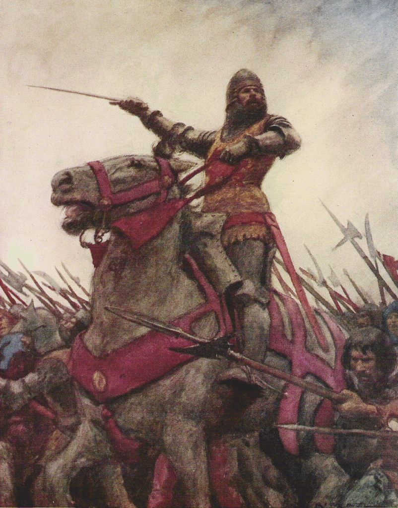
Owain Glyndwr (perhaps on his favourite horse Llwyd y Bacsie) by Andrew Cadwgan Michael (Image: Wikipedia)
A 2015 article by Lieutenant-General Jonathon Riley in The Welsh History Review (available on the Generalship website) considers The Military Garrisons of Henry IV and Henry V at Strata Florida, 1407 and 1415-16. The author states: “The garrison of 1407 was a punitive force during the closing stages of Glyndwr’s rebellion; that of 1415 was to suppress possible dissent during the absence of Henry V in the Agincourt campaign.” Of Strata Florida’s economic and wider strategic importance, he writes:
The abbey lands were located on the southern frontier of what had recently been – maybe still was – bandit country. It lay on the very westernmost edge of the Cambrian Mountains, at the head of the valley of the River Teifi which ran south and west into the Irish Sea at Cardigan, nearly sixty miles away. Between the abbey and the sea lay a strip more than ten miles wide on the north bank of the Teifi, some of it marsh, like the great bog of Tregaron, but much of it fine agricultural land suitable for mixed farming. To the east, the uplands provided valuable summer pastures for sheep, cattle and ponies as well as slate, building stone, silver, lead and copper: the Cistercians were well known as sponsors of major medieval industrial complexes working metal. Tracts of this upland had been ceded in previous centuries to the military orders to provide income for the upkeep of the Christian kingdoms of Outremer in the Holy Land – hence the place names that still endure: Ysbyty Ystwyth for the Hospitallers, Temple Bar for the Templars. All this meant a money-based economy, and as elsewhere in medieval Europe, the Cistercians were the bankers who serviced this economy…..
Outremer is a term used to describe European ‘crusader states’ in the Middle East between 1098-1291. However, according to one assessment, “it was as agriculturists and horse and cattle breeders that the Cistercians exercised their chief influence on the progress of civilisation in the Middle Ages.” Whilst this judgement by posterity might not recognise the significant religious and cultural legacy of Strata Florida, it does seem to chime with key interests of the abbey as reported by Gerald of Wales during his travels in the late 12th century. Nevertheless, it was the horses of Powys that most impressed Gerald.
Horses, War and Religion
Medieval Powis Castle near Welshpool depicted in the late 18th century (Image source: National Library of Wales/Wikipedia)
In this third district of Wales, called Powys, there are most excellent studs put apart for breeding, and deriving their origin from some fine Spanish horses, which Robert de Belesme, earl of Shrewsbury, brought into this country: on which account the horses sent from hence are remarkable for their majestic proportion and astonishing fleetness.Gerald of Wales
Whilst the above account unsurprisingly suggests that warfare was the key spur for horse breeding in the Middle Ages – a theme explored in depth by the Medieval Warhorse project – the evidence below indicates the Powys Cistercian abbeys of Cwm Hir and Strata Marcella probably bred animals for a range of uses. The following description is also likely to reflect the monastic horse business in Mid Wales.
Horse breeding and trading was evidently a specialism of the Yorkshire Cistercian houses and the White Monks here were renowned for their quality. The superiority of their horses was clearly appreciated in royal circles, for in 1236 Henry III requested two palfreys, stipulating that these should be of northern parts, good and fit – he received one from Rievaulx and one from Jervaulx. The attraction of owning one of these quality horses may have encouraged donors to grant land to the abbey. This was the case at Furness, where a donor requested an honourable horse in return for his generosity to the community.
Indeed, a website dedicated to the life and work of late Medieval Welsh poet Guto’r Glyn has a page which points to the equestrian patronage of Dafydd ab Owain, presumably at that time Abbot of Strata Marcella. He is celebrated in the following poem extract along with the abbey’s prosperous landholdings at Ystrad Marchell which roughly co-incides with the parish of Welshpool (‘Y Trallwng’ in Welsh).
Ni bu dir yn y byd well, Bwyd meirch lle bu ŷd Marchell, Gwenithdir, gweirdir a gwŷdd, A galw ’dd wyf Arglwydd Ddafydd….
Never was there better land in the world, horse-fodder where Marcella’s corn used to grow, land for growing wheat, land for growing grass and trees, and I call Lord Dafydd….. (poem 115.13-16)
The ‘Horses’ page is also interesting in the different words for horses used by Guto’r in another poem: “Several terms are used in the poem to refer to the animal requested, namely: march, gorwydd, eddestr, and planc… Hacnai is a borrowing from English and denotes a horse of middling size or a riding horse.” Meanwhile, the significant number of poems addressed to Dafydd ab Owain by Guto’r and other poets requesting gifts of horses seem to underline the abbot’s (later bishop) position as a notable breeder.
Some Concluding Thoughts
Roman Cavalry re-enactor at Scarborough in Yorkshire (Image: David Friel, Flickr/Wikipedia)
The Sws Way (Sarn Sws) was an ancient Roman trackway that reputedly ran from Brecon in modern day South Powys to Caersws in North Powys and thence across the English border to Chester, although only evidence for the northern section of the route is available. Like Caersws, Brecon was a major Roman military outpost according to CADW “manned by highly trained legionaries of the Vettonian Spanish Cavalry Regiment.” It is therefore possible that the influence of Spanish and other European horse breeds on Welsh (and British more generally) stock predates the Medieval period and may even be pre-Roman. Moreover, “the linguist John Rhys noted that the dialect of Mid-Wales Welsh (Y Bowyseg) was closer to the Gaulish language than its neighbours, and concluded that the area had pre-Roman links to Gaul.” (See Wikipedia entry for Caersws) Clearly not speculation is the strategic location of the village which has made it an important centre during various historical periods. The preceding discussion and the earlier post on the location of a royal horse stud in the area during the Tudor dynasty reflect this position.
Etymology and toponymy can pose both a challenge and opportunity for historical research and those of Eskermayne and, indeed, Caersws itself (a fitting subject for another blog!) make interesting case studies. A January 2023 webinar led by Dr Dylan Foster Evans of the Welsh Place-Name Society for the Cambrian Mountains Society highlights prevalence of the word ‘esgair’ (ridge or ‘esker’). Meanwhile, the etymology of ‘maen’ (stone) is explored here. Whilst Esgair Maen (Anglicised form Eskermayne) is used to denote individual place names in the Cambrian Mountains hinterland near Strata Florida and Llanidloes, for instance – and gives title to part of the Robert Dudley estate discussed previously – it is also possible that the name might have been used to describe a wider landscape of stone ridges which included the Park estate near Caersws. A recent helpful email exchange with Professor Robert Liddiard of the Medieval Warhorse project confirms the probability that the Park and Eskermayne studs were one and the same, based on various accounts for stock numbers of around 100 (or, more precisely, 97 mares, 11 fillies, and 4 colts for Eskermayne in 1547). It is also possible that the ‘unknown’ location of another Tudor royal horse breeding site in Wales might coincide with the former landholdings and equestrian operations of Cistercian abbeys in Mid Wales, including the granges of Strata Marcella, Cwm Hir and Strata Florida. What is certainly the case is the regional land-based economy of the Medieval and Earl Modern periods was highly diverse and dynamic, with horses playing a vital role. Returning to R J Moore-Colyer’s account of Montgomeryshire horses, the lasting impression is quite magical although, sadly, around Caersws the animals have long disappeared.
The native ponies, for centuries known as ‘merlins’, ran virtually wild on the hills….
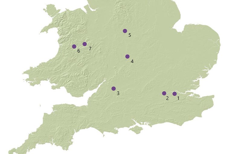
Map showing major royal horse breeding sites in mid-Tudor England and Wales 1.Eltham Palace 2. Hampton Court 3. Malmesbury 4. Warwick 5. Tutbury 6. ‘Eskermayne’ (Caersws) 7. Unknown (Source: Royal Armouries)
Whatever their views on the British monarchy, most people (including republicans it seems) were impressed by the pageantry of King Charles’ and Queen Camilla’s recent coronation, including its magnificent equestrian processions. Queen Elizabeth II was also famously associated with conservation of Britain’s equestrian heritage, including the nation’s horse and pony breeds. Aside from her patronage of thoroughbred race horses, the late queen supported the breeding of Cleveland Bays as well as Fell and Highland ponies The Anglo-Welsh Tudor dynasty too engaged in some famous equestrian patronage during the 16th century, when horses obviously played a far greater role in society. During the reigns of Henry VIII and Queen Elizabeth I a royal park and stud were established in the environs of the present day village of Caersws on the River Severn in North Powys (the former Mid Wales County of Montgomeryshire), with a second located at an unknown location near the borders of England and Wales (No.7 in the above map) known as The Marches (‘Y Mers’ in Welsh). This article considers some of the historical evidence for the royal horse park of ‘Eskermayne’ and the light it throws on the importance of Welsh equestrian heritage together with the landscape ecology of the Caersws Basin in Tudor and pre-industrial times before its late modern transformation.
Historical origins of ‘Eskermayne’
Some records for a property called ‘Esgir Maen’ (probable Welsh meaning ‘stone ridge’), Anglicised as ‘Eskermayne,’ go back to 1530 and can be found in a 2020 University of Wales Trinity St David PhD thesis by Heather Para on Monastic Development and Dissolution in Wales: Continuity or Change for Uchelwyr? (Page 302). The precise location of this landholding is unclear, but much of present day Caersws village is located on a ridge or ‘esker‘ beyond the River Severn flood plain. Coincidently, the absence of property records for ‘Eskermayne’ from the mid-16th century to 1625 are concurrent with the establishment of a royal park and stud in the Caersws area, probably enabled by Henry VIII’s Acts of Union and Dissolution of the Monastries together their landholdings. ‘Uchelwyr‘ are defined as gentry and “nobles descended from the pre-conquest native Welsh royal dynasties.” The contemporary writer Oliver Mathews claimed family association with the Caersws landholding known as Park Farm (see below) apparently used for the royal park, although this seems to have been disputed by other commentators. Nevertheless, Mathews’ account of the park’s establishment is a key source of information for the Tudor royal enterprise.
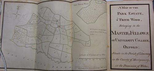
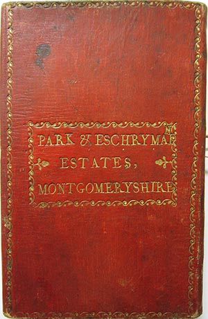
His and other accounts have more recently been corroborated in an archive compiled by Dr Robin Darwall-Smith of University College Oxford for a group of properties in the former manor of Arwystli in Montgomeryshire/North Powys bequeathed to the college by Robert Dudley, Earl of Leicester, on his death in 1588. A 2018 article by Dr Darwall-Smith which accompanies the archive refers to “a leather book” containing two late 18th century maps, plus “a charming water colour,” which describes the ‘Park and Eschrymain Estates’ (shown above). Whilst the main archive seems to identify ‘Escrhymain’ with various landholdings in the Severn Valley and Caersws Basin between Penstrowed and the Llanidloes area, the ‘Park Estate’ is clearly located to the west of Caersws (towards the village of Trefeglwys) and north of the ‘Trannon Brook’ (River Trannon). The topography of this location also includes the form of a distinct ridge (or esker) and the historic map identifies the contemporary landholding of ‘Park Farm’ (or ‘Coed Y Parc’) together with neighbouring properties in the general B4569 corridor. Here it seems probable was the royal park and stud of the Tudor dynasty.
Importance of Equestrian Sector
Tower of London portrait of Queen Elizabeth I riding a horse (Image: National Education Network)
…. the heavy Montgomeryshire animals had probably originated from the royal stud at Caersws, established in the mid-sixteenth century with the object of breeding large, tractable horses for military purposes under the terms of Henry VIII’s various legislative measures. Around I540 it had been proposed that the park of Caersws, together with the farms of Penprise, be reserved and fenced for the King’s use, a task which could be accomplished at little cost since there was ‘a great plenty of oke’.*The officers drawing up the proposal outlined arrangements for the maintenance of 100 mares and 10 stallions of suitable size in the newly fenced park, and set out detailed instructions for the dispersal of their progeny. Like all emparkments the Caersws project did not proceed uncontested, with men of the mettle of the chronicler Oliver Mathews complaining of the ‘… given awaie of the parkes of Caerouse from the burgesses to keep the King’s breedinge mares’**
*State Papers (Domestic), Hen. VIII, vol Vll, 1574. ** Anon, Mont Coll, XVI, 1863, p 16
The article goes on to describe the subsequent operation of the royal stud and park, it’s later decline and significant equine heritage legacy:
….When Elizabeth I granted the manor of Arwystli to Robert Dudley, Earl of Leicester in I57I, the Caersws stud was in operation. Significantly, Dudley’s predecessor was William, Earl of Pembroke, Master of the Horse, who had probably held Arwystli on condition that he maintain the royal breeding stock.* The enthusiasm with which Dudley’s henchmen discharged their duty is open to question since William Harrison was prompted to note in I577 that however successful the King’s ‘noble studdery’ had been in the past, ‘the officers, waxing weary, procured a mixed brood of bastard races, whereby his good purpose came to little effect’.** Nevertheless, when the Montgomeryshire District Entire Horse Association set about improving local draught horses in the later nineteenth century, they were working with animals directly and collaterally descended from the royal foundation stock, which had steadily improved on the lush pastures and heavy soils of lowland Montgomeryshire.
* Calendar of Letters Patent, 1571 **Edelen, op cit, p 48.
Landscape of the Caersws Basin
A contemporary view towards the Park Farm from the Roman Road (Cycle Route 81) between Caersws and Llandinam/Trefeglwys. (Picture: Janet Mackinnon)
Extensive background information on the Caersws Basin (a registered historic landscape) can be found on the Clwyd Powys Archaeological Trust website (CPAT). A section on the ‘Post-Medieval and Modern period’ states that:
Renders paid by the tenants of the manor at Park (see above) in the early 13th century… make it clear that this was a hunting park in the Middle Ages, which was probably one of the reasons why it became a royal horse stud by the later 16th century… The earls of Pembroke had been granted all demesne, lands, and meadows in ‘Park Penprise’ in 1562, and it is probably significant that during this period William, earl of Pembroke and Robert, earl of Leicester, successively the steward and lord of Arwystli, also both held office of Master of the Horse. Powys had been a noted centre of horse breeding since the Middle Ages, Gerald of Wales surmising that the blood-stock in the later 12th century could be traced back to Spanish horses imported by the earl of Shrewsbury, in the late 11th or early 12th century.
The preceding limited but interesting accounts of the Caersws Basin’s equestrian heritage during the later medieval and early modern periods strongly make the strong case for further historical research; as does evolution of this landscape over a longer time frame given the need for greater resilience to climate change integrated with nature restoration. Information published by CPAT and other organisations evokes a vibrant mixed use landscape, dominated by wetlands, forests of oak and wood pasture maybe with similarities to the contemporary Windsor Great Park but in an, arguably, more spectacular location. Such work might build upon Exeter University’s Medieval Warhorse project:
…in the field of landscape history, the work has generated entirely new information about an aspect of the medieval countryside (the horse stud) that had been neglected. Over 800 medieval documents have been examined to provide information on the nature and organisation of studs, principally during the High Middle Ages. The project produced the first ever mapping of the English royal stud network, clarified the number and location of stud sites (within parks), characterised their landscape contexts (frequently in uplands or wetland zones), and reconstructed their hinterlands.
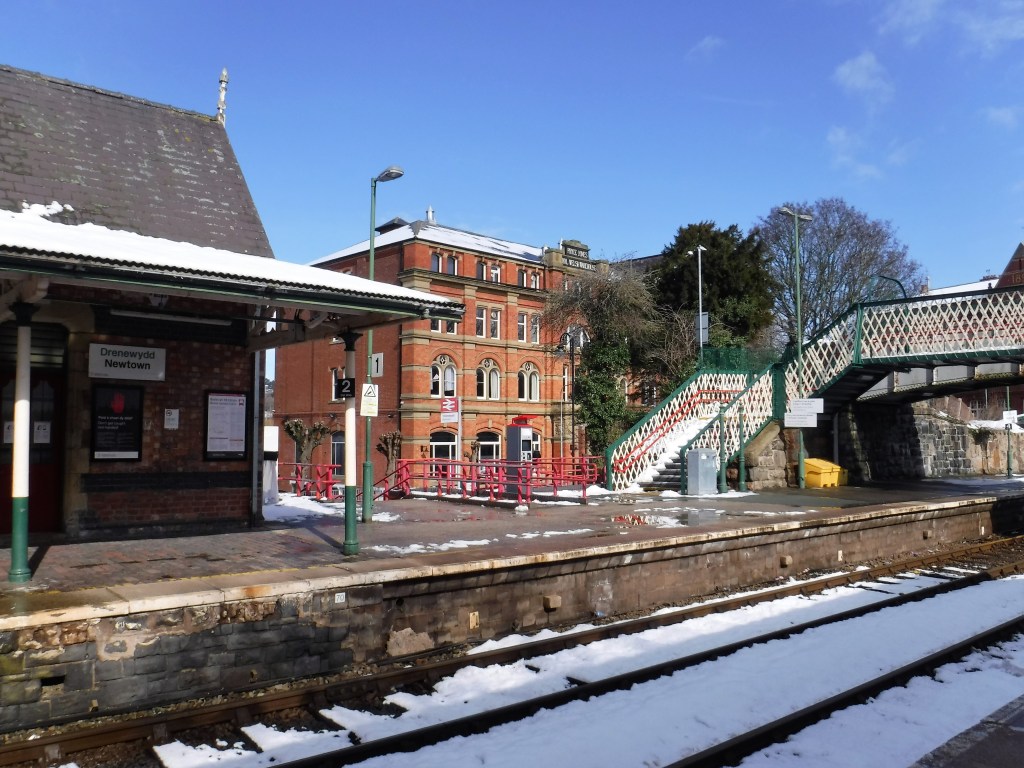
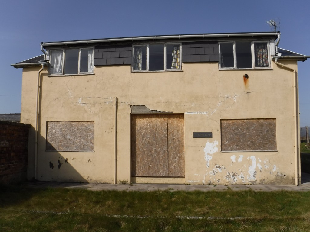
A recent report by property company Grosvenor, the National Trust, social landlord Peabody, Historic England and the Crown Estate suggests that improving the energy efficiency of the UK’s historic buildings could reduce carbon emissions by up to 5% and generate an estimated £35 billion in economic output, whilst making properties more affordable to heat. The report comes at a time when many historic buildings are falling in to disuse, disrepair and dereliction. This problem is evidenced by Newtown in Powys, an important gateway to Mid Wales, where the train station and its environs have a fine legacy of Victorian architecture and urban design, including Pryce Jones Royal Welsh Warehouse and St David’s Church, but also an air of decay. Indeed, there was a local outcry in 2021 when a historic chapel collapsed due to disrepair, and Newtown residents continue to express concern about support for civic heritage from the relevant authorities. Regeneration of the historic environment would seem an ideal candidate for levelling up in the next round of Powys funding bids to the UK government.
Newtown, Powys railway station: an important gateway to Mid WalesPartly empty Pryce Jones Royal Welsh Warehouse during snow in March 2023
Derelict St David’s Church designed by Thomas Penson
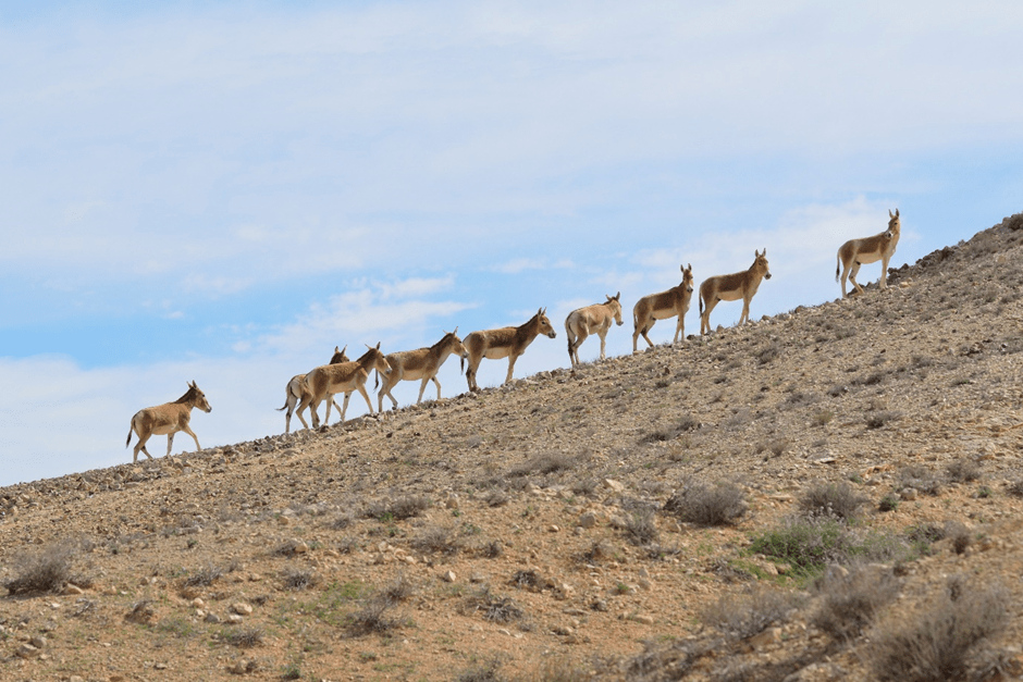
Onagers (wild ass) in the Negev Desert, Israel (Image: Gideon Pisanty, Wikipedia)
Who set the wild donkey free? Who loosed the bonds of the onager, Whose home I have made the wilderness, And the barren land his dwelling? He scorns the tumult of the city; He does not heed the shouts of the driver. The range of the mountains is his pasture, And he searches after every green thing.
This post revisits potential roles for equids (horses and donkeys) in nature conservation, previously considered in a 2020 ECOS article where the focus was on extensive grazing in Britain but with reference to the equine programmes of Rewilding Europe. The perspective here is more global, and primarily seeks to distinguish between wild and feral animals, re-introduced species, ‘primitive’ horses, landraces and domesticated breeds, together with some key issues for their management in a range of nature conservation and restoration environments. A better understanding of equine natural history and equestrian heritage is advocated to support more informed discussions about animal and landscape management programmes, as well as sustainable grazing for recreational equids.
Nature and ‘Management’
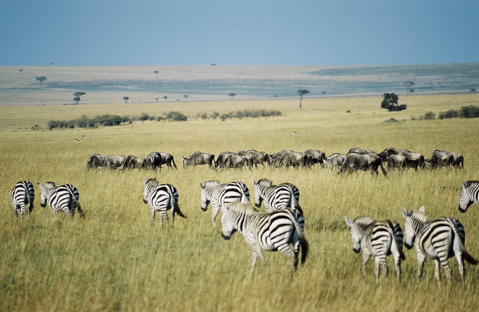
Millennia before Yahweh, the original god of Middle Eastern monotheism, identified the onager as a wild equid, Aboriginal peoples were managing ‘wilderness’ areas. Human interventions in the landscape, including that of Old Testament West Asia, and influence on animal populations extend from prehistory to the present. Given the importance of free ranging equids as a food source for humans prior and after domestication, such interventions will have influenced equine natural history. Moreover, equids are regarded as having a key role in the development of pastoralism. Now in regions such as Northern Kenya, management of wild animal populations, including zebra, is increasingly co-dependent on sustainable livestock grazing.
Zebra and Wildebeest herds in Kenya’s Maasai Mara (Image: Key 45, Wikipedia)
Wild Equids: Onager and Zebras
The onager is closely related to the African wild ass, as they both share the same ancestor. There are now probably less than 600 of the latter in the wild, with the species listed as critically endangered by the International Union for the Conservation of Nature. As with zebra, competition with livestock for grazing and water supplies, along with hunting for food and traditional medicines, pose major threats notwithstanding their protected status. Whilst the Asian wild ass or onager has fared better, one of five sub-species (the Syrian wild ass) is now extinct, two are endangered, and two are near threatened. Habitat loss is the main reason for decline in populations. The onager formerly had a wide territorial range from Europe across south west, central and northern Asia. Typically, onagers live in hot and cold deserts together with other arid and semi-arid regions, including grassland plains, steppes and savannahs. Persian onagers are currently being reintroduced in the Middle East as replacements for the extinct Syrian wild ass in the Arabian Peninsula, Israel and Jordan. Similarly, Rewilding Europe has a re-introduction project for onager (kulan) in the steppe of southern Ukraine. Kiang are genetically distinct species of wild ass native to the Tibetan Plateau, Ladakh and Northern Nepal with most distribution in China.
Kiangs in the vicinity of Tso Moriri, Ladakh (Image: Jacques Piri, Wikipedia)
There are three living species of zebra: the Grévy’s zebra, plains zebra, and the mountain zebra. Zebras share the genus Equus with horses and asses, the three groups being the only surviving members of the family Equidae. The IUCN lists the Grévy’s zebra as endangered, the mountain zebra as vulnerable and the plains zebra as near-threatened. Grévy’s zebra populations, although stable, are estimated to include less than 2,000 mature individuals. Mountain zebras number approximately 35,000 individuals and their population seems to be increasing. Plains zebra are estimated to number some 150,000–250,000 with a decreasing population trend. Human intervention has fragmented zebra ranges and they are threatened by habitat destruction and hunting for their hide and meat. Zebra also compete with livestock and fences obstruct their territories. In addition, civil wars in some countries have caused populations declines. Zebras are native to eastern and southern Africa and live in a variety of habitats such as savannahs, grasslands, woodlands, shrublands, and mountainous areas.
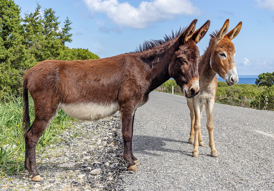
Feral Horses and Donkeys
The term ‘feral’ (and semi-feral) is used here to describe animals that have ‘rewilded’ themselves following domestication. They are not the genuinely wild equids described previously, or the re-introduced ‘primitive’ Przewalski’s horse described below. ‘Free-roaming’ is a term sometimes applied to both feral and deliberately rewilded horses and donkeys. For instance, current research by The Donkey Sanctuary notes that: “The emergence of free-roaming donkey populations has brought novel challenges for conservationists, land managers and animal welfarists alike. In many places they are categorised as ‘non-native’ and so framed as illegitimate and ‘out of place.’” An example of the latter categorisation is the use of ‘invasive species’ to describe feral horse and donkey populations in Australia, where they are widespread. Although equids are non-native to Australia, there are very different views on how they should be managed with animal welfare and compassionate conservation agendas increasingly cited, along with claims that feral horses and donkeys are now part of local ecosystems. Elsewhere, including Saudi Arabia, feral donkeys have been identified as ‘pests’ when they occupy the former range of wild ancestors. By comparison, both free-ranging and formerly domesticated equids are welcome and regarded as important ‘heritage’ in some countries, including North Cyprus and Namibia.
Natural adaptation of semi-wild or feral equids is sometimes associated with the development of distinctive ‘ecotypes‘ However, the term is still relatively undefined for equine application, as is the relationship between this and ‘landrace’ (see below). An example of its usage can be found in this account of Serrano horses involved in rewilding the Iberian Highlands.
Feral donkeys in Northern Cyprus (Image: Michal Klajban, Wikipedia)
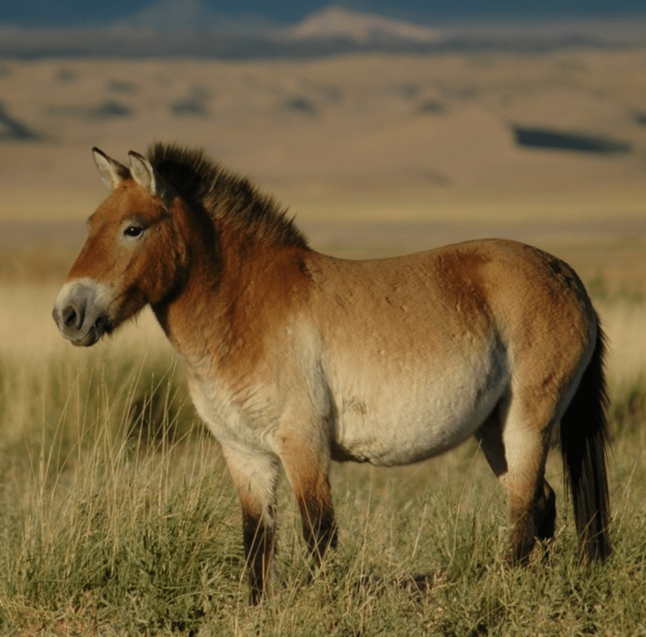
Re-introduced ‘Primitive’ Horses
Przewalski’s horse is generally accepted as the only genuine ‘primitive’ or wild surviving equid. However, Rewilding Europe are working to create a formal (administrative) ‘status wild’ for others horses, including Konik, used in nature conservation and restoration programmes. Whilst Koniks are now strongly associated with European rewilding and similar projects, largely because of recent unregulated breeding and plentiful supply, they are the progeny of deliberate breeding from a small founder population in Poland during the early 20th century. By contrast, Przewalski’s horse, also known as the Mongolian wild horse, Dzungarian horse or takhi, is a rare and endangered equid originally native to the steppes of Central Asia. Once extinct in the wild, it has been reintroduced to its native habitat since the 1990s in Mongolia at the Khustain Nuruu National Park, Takhin Tal Nature Reserve, and Khomiin Tal, as well as several other locales in Central Asia and Eastern Europe, including the Chernobyl Radiological and Ecological Biosphere Reserve. Nevertheless, the primitive status of Przewalki’s horse was challenged in 2018 when DNA analysis of equine remains associated with the 5,000-year-old Botai culture of Central Asia revealed the animals were of Przewalski lineage, although the domestication status of these animals is questioned. Still, there remains a case for the Botai culture as a major user of domestic horses by about 3,500 BC, nearly 1,000 years earlier than the previous scientific consensus.
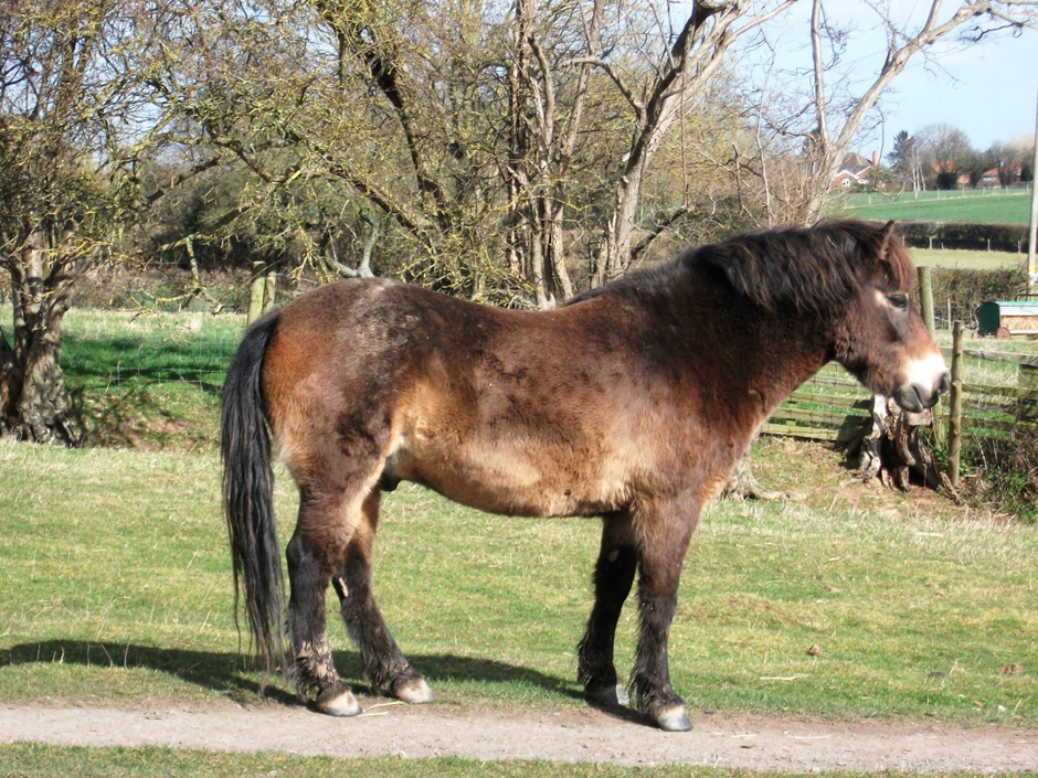
There is a useful discussion of the differences between landraces and horse breeds in the June 2018 issue of the US magazine EQUUS. Whilst these differences may not be as clear cut as the article suggests – the Exmoor pony is a case in point – it may still be useful to consider ‘landraces’ as “a population of feral horses that has adapted to its natural and cultural environment over time”. In Wales, this include semi-feral populations of hill ponies, such as those found in the Carneddau Mountains These are distinct from the Welsh Mountain Pony breed. The Exmoor pony, on the other hand, is described as both a landrace and a breed, and considered by some experts* as perhaps the closest surviving ancestor of the wild horse in Europe. As their names suggest, Carneddau and Exmoor ponies, along with other hardy native breeds, are strongly identified with the mountains and moorlands of the British Isles, including Ireland. Along with their habitats, including national parks and other protected areas, they are, therefore, regarded by many as an important part of our national heritage. However, this has not always been fully understood or recognised by groups involved in nature conservation and restoration who have introduced Konik horses (see above) without due consideration.
Further discussion of the natural history of the Exmoor pony can be found in this article: Baker S, Greig C, Macgregor H and Swan A (1998) Exmoor ponies – Britain’s prehistoric wild horses? British Wildlife, 9 (5), 304-313 as well as *Dr Sue Baker’s book Exmoor Ponies Survival of the Fittest – A Natural History
Exmoor Pony kept on Worcestershire common, English Midlands (Image: Janet Mackinnon)
Sustainable Equine Grazing
Although the preceding reference to the use of Koniks for conservation grazing and nature restoration projects in Britain may imply criticism, this is rather intended as a caveat about the need to better acknowledge the natural heritage importance of British mountain and moorland ponies. In fact, there may be practical and welfare reasons for the employment of Koniks arising from their relative ease of acquisition and management (an important consideration for smaller nature conservation groups) and, possibly, reduced vulnerability to grazing-related health conditions such as laminitis and grass sickness Nevertheless, at the present time comparative research on British native ponies and Konik horses is lacking, mainly due to shortage of funding. In the meantime, greatly increased media coverage of climate change and nature decline is finally registering with more organisations and individuals involved in keeping horses for their main contemporary purpose of recreation in Western countries. For instance, the University of Liverpool has recently conducted An Exploration of Environmentally Sustainable Practices Associated with Alternative Grazing Management System Use for Horses, Ponies, Donkeys and Mules in the UK which notes that “equestrian grazing management is a poorly researched area, despite potentially significant environmental impacts.” What is certainly obvious is that many horses could be managed and grazed more sustainably for their own benefit and that of the environment.
Palomino riding horse grazed on Worcestershire common land (Image: Janet Mackinnon)
Some Concluding Reflections
As mentioned at its beginning, this post revisits a 2020 ECOS article on the use of equids for extensive grazing (in nature conservation, restoration, rewilding etc) mainly in Britain, and then locates this theme within a broader global context to provide a better understanding of equine natural history and equestrian heritage. The subsequent narrative demonstrates the importance of wild asses in this context, the existence of only one species of genuinely wild horse, and the need for a more comprehensive overview of feral horses and donkeys where these are both generally welcomed or regarded as invasive species. A distinction is again made between European Konik horses and British native landraces and heritage breeds associated with mountain and moorland environments. Also, since the 2020 article further research has been carried out on measuring the welfare of free-roaming horses. Finally, the need for more sustainable grazing in the management of equids kept for recreation is highlighted. The latter requires greater collaboration and co-operation between environmental and equestrian stakeholders, particularly educators, with the proviso that equine matters are sometimes contentious.
Horses for a quarrel. Camels for the desert., And oxen for poverty. Arab proverb
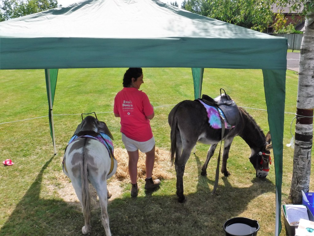
Donkey assistance team visiting a primary school in Mid Wales (Image: Janet Mackinnon)
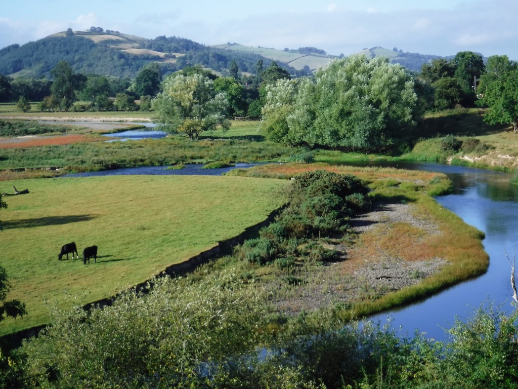
Caersws Basin with view up the River Severn toward Cefn Carnedd in 2022 (Image: Janet Mackinnon)
This blog launched in March 2021 with a post on the Severn Valley Water Management Scheme promoted by the River Severn Partnership as part of a proposed Severn Regional Growth Zone. Like the majority of major spatial programmes, these initiatives at first met with significant public opposition and scepticism, not least with regard to the proposal for a combined Shrewsbury dam and relief road which was subsequently dropped. This post will consider how large-scale programmes involving landscape, built environment and spatial regeneration might be better integrated and communicated to stakeholders, including the public. The starting point is a consideration of what is meant by the term ‘regeneration’ in the three contexts identified. Two case studies are then considered: the proposed Severn Regional Growth Zone and a mooted Cambrian Regeneration Zone for Mid Wales. The potential relevance and application of ‘integrated regeneration’ is then considered for Ukraine’s post-war recovery.
Landscape Regeneration
The concept of ‘landscape regeneration’ is, on the one hand, a potential extension of spatial planning and, on the other, a much-needed means of restoring land use principles to the practice of area-based (now usually called development) planning in Britain. Like many novel ideas, it is not at present either fully defined or widely understood but a recently-established Centre for Landscape Regeneration at Cambridge University offers some very helpful insights. CLR’s mission is “to provide the knowledge and tools needed to regenerate the British countryside using cost-effective nature-based solutions that harness the power of ecosystems to provide broad societal benefits including biodiversity recovery and climate mitigation and adaptation.” Similarly, the Devon Environment Foundation locates landscape regeneration within a broad range of “initiatives such as regenerative agriculture, agroforestry, rewilding, tree planting, meadow restoration, peatland conservation and restoration, eco tourism, wildlife safaris, and much more.” Both Cambridgeshire and Devon are also pilot areas for a new land use framework approach promoted by the Food, Farming and Countryside Commission, later recommended for rollout in England in a House of Lords report.
Built Environment Contexts
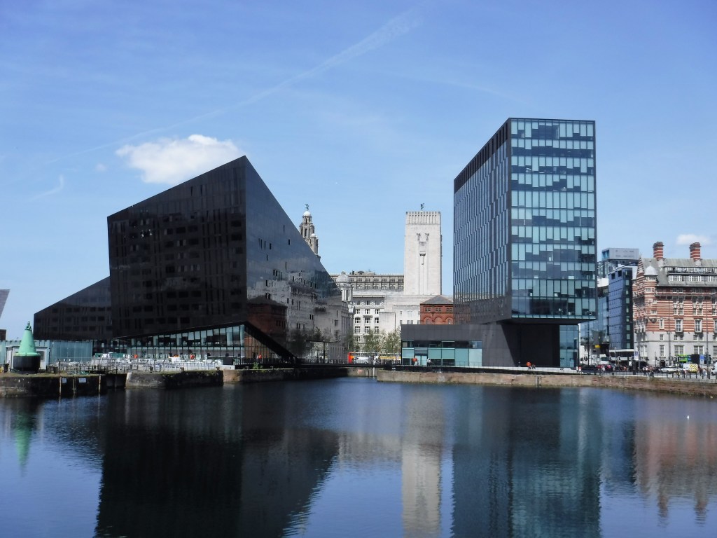
Re-development of Liverpool’s world-famous waterfront has attracted some criticisms (Image: Janet Mackinnon)
‘Urban regeneration’ (or reconstruction as it was known in the mid-20th century) is historically linked to programmes to re-build towns and, particularly, major cities devastated by World War II. Many re-constructed European city centres are still regarded as outstanding examples of this. However, for various reasons, including lack of high quality public transport provision, the process was widely considered to be less successful in Britain’s large urban areas, partly contributing to their decline by the 1970s. This was subsequently much hastened by de-industrialisation which, combined with the development of container ports, created vast inner city wastelands in places like Liverpool and London Docklands. The term ‘regeneration’ started to be applied during this period and has since become a multi-disciplinary focus for policy and practical interventions in the built environment and local economy in an ever-increasing range of international contexts. However, there has also been a tendency for urban regeneration to return to its classical roots in re-construction with the expression ‘place-making” now often deployed, alongside ‘urban design,’ sometimes provoking aesthetic debates. There have also been specific criticisms of so-called ‘prettification’ schemes in ‘left-behind’ communities and wider critiques of the unsustainability of much development, particularly in its prevailing form of urban sprawl.
Spatial Planning Dimension
Northern European planning has tended to have both a strategic and land use dimension lacking in Britain, as reflected in the following definition:
The aim is to create a more rational territorial organization of land use and the linkages between them, to balance demands for development with the need to protect the environment, and to achieve social and economic objectives (Wegener, 1998). Spatial planning tries to coordinate and improve the impacts of other sectoral policies on land use, in order to achieve a more even distribution of economic development within a given territory than would otherwise be created by market forces. Spatial planning is, therefore, an important function for promoting sustainable development and improving quality of life.
Spatial planning in the English West Midlands and South West regions of SRGZ (and other growth areas) has been dominated since the 2000s New Labour Regional Spatial Strategies by housing-led development but without tackling the root causes of supply-side and market-driven shortages at a national (or sub-national) level. In the meantime, increasing urban sprawl has made parts of the country among the most vulnerable to flooding even more so. The proposed SRGZ is in some respects a worthy attempt to promote a more integrated regional development model, particularly with regard to reducing flood risk. For instance, the latest iteration of the Severn Valley Water Management Scheme consultation refers to ‘A Landscape Vision.’ This suggests the possibility of holistic landscape regeneration, of the kind described above, within the Severn Uplands catchment area as well the Severn Valley in Powys and Shropshire based on the existing catchment-based approach. However, such a comprehensive approach would require unprecedented levels of co-operation and co-ordination between the UK and Welsh government administrations, as well as respective lead public bodies, the Environment Agency and Natural Resources Wales; in addition to the myriad of other stakeholders. Nevertheless, there are some grounds for optimism that progress is being made.
Whilst the county is approximately 25 per cent of the landmass of Wales, it has only five per cent of the population. The population in Powys is older compared to the rest of Wales and the proportion of older people is growing. The working age adult population is smaller compared to the rest of Wales and it is predicted that the number of young people and working age adults will decrease, whilst the number of older people will increase. It is predicted that there will be an eight per cent decline in the Powys population by 2039. (Paragraph 1)
Although 2021 census data casts doubt on whether the final sentence is actually correct – the county is now forecast to have a small increase in population by the early 2040s – the demographic contrast with projections for neighbouring Shropshire is still quite remarkable. Moreover, the Ceredigion area experienced a 5.8% decline in population between 2011-21, the largest in Wales. Given the demographic challenges posed by Mid and West Wales, in 2020 the author of this blog proposed a Cambrian Regeneration Zone for Powys and Ceredigion based on enhanced investment in rail, energy and digital infrastructure to help rebalance and level up the regional economy and encourage working age adults to remain and come to live in the region. A landscape regeneration vision for the Cambrian Mountains was also put forward as a key part of the programme. Meanwhile, a monumental scheme for a Powys Crematorium was submitted by a local developer with the backing of the County Council, but later refused planning consent by the Welsh Government because the proposed location was unsustainable for its operation.
Integrated Regeneration Model
Some of the challenges for integrating landscape with built environment and spatial regeneration have been described above. Aside from technical issues, those of governance and management are central. Even in a relatively well regulated ‘environment’ such as the UK, there are significant problems with governance and implementation of standards. This was highlighted recently when the UK government’s progress with environmental targets was called in to question by non-government organisations. Added to this is the tendency for land-based sectors, including agriculture, property and construction to be regulation-averse in various ways. Public watchdogs have also been weakened by successive governments with their remits increasingly laissez-faire, leading to major problems across built, green and blue environments from the cladding scandal to river pollution. Whilst professions bodies such as the Royal Town Planning Institute and Royal Institution of Chartered Surveyors are fully aware of problems within their respective areas of responsibility, there is a tendency for the public and private sectors to use gaslighting strategies when difficult questions are raised. Therefore, the starting point for better integration of regeneration models is likely to be greater transparency, political accountability and effective communication.
Post-War Recovery in Ukraine
V N Karazin Kharkiv National University in 2014, the year of Russia’s first invasion of Ukraine (Image: Николай Слета)
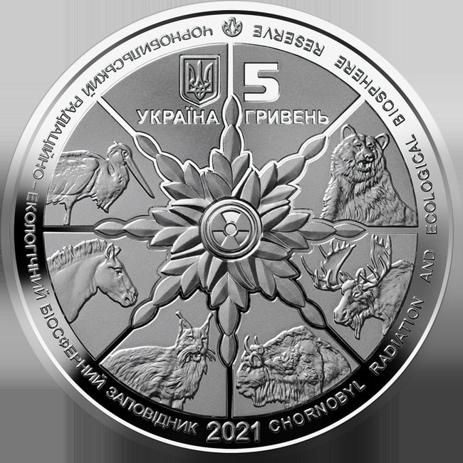
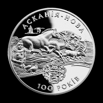
In October 2022, the nature conservation journal ECOS published a feature on nature and war in Ukraine which discussed the impact of conflict on areas including the Chernobyl Radiation and Ecological Biosphere Reserve as well as the Danube Delta region and Azov-Black Sea Corridor. During peacetime, commemorative coins for the Chernobyl and Askania-Nova biosphere reserves were issued to celebrate the country’s remarkable achievements in nature restoration. Sadly, Askania-Nova is currently on Kherson region’s Russian-occupied frontline.
And ‘mid this tumult Kubla heard from far/Ancestral voices prophesying war
Samuel Taylor Coleridge, Kubla Khan, 1797/1816
Near the beginning of Leo Tolstoy’s great Russian novel War and Peace, a character observes that the British are so mercantilist in their conduct of foreign affairs. The year is then 1805, but the villain of the peace on this occasion turns out to be the Emperor Napoleon whose French army invades Russia in 1812. As the saying goes, the rest is history. Writing in the Soviet period between 1928-40, also on epic scale about an earlier historical period, Mikhail Sholokhov would later become known as “the Red Tolstoy” for his four-volume novel The Quiet Don. Although doubts have been raised about Sholokhov’s authorship of what is generally regarded to be one of the great masterpieces of Soviet realism, these are not considered here. For the immediate contemporary interest of The Quiet Don quartet lies in the novel’s depiction of conflict between Ukrainian and Russian peoples in the aftermath of World War 1 and the Bolshevik Revolution. In some respects what became a civil war anticipates the crisis in relations between Russia and Ukraine which has unfolded since 2014.(1) However, this crisis is not just about Russian hegemonic aggression and Ukrainian sovereignty, it is about how European (including British) neo-mercantilism took precedence in the conduct of diplomacy with Russia and other nations in the “Post-Soviet Space” during the early 21st century.(2/3) What one commentator called “Putin’s Khanate” has become a geopolitical problem which is partly of the West’s creation.(4) Tragically, once again all is not quiet on the eastern front; although since this blogs was first posted, Ukraine’s allies have done much to support a country on, to use some words of Winston Churchill, “the frontline of freedom.”(5/6/7)
Former empty house – now under renovation – in a Welsh coastal village (Janet Mackinnon)
Along with the sustainability of agriculture and food systems (as well as other major supply chains), the sustainability of built environments, including infrastructure, poses one of humanity’s greatest challenges. This post will focus on the regeneration of previously developed land and buildings, with the added proviso that from an environmental perspective site re-use is generally preferable to redevelopment.(1/2) It also draws on a body of work published by the European Union between 2018-21 using the acronym RESTORE (Rethinking Sustainability Towards a Regenerative Economy) and, in particular, a 2018 report entitled Sustainability, Restorative to Regenerative. (3/4) This report carries the extended subheading: “An exploration in progressing a paradigm shift in built environment thinking, from sustainability to restorative sustainability and on to regenerative sustainability.” RESTORE describes itself as “the first carbon net positive European research project and network.”(5) The 2018 report defines “regenerative sustainability as “enabling social and ecological systems to maintain a healthy state and to evolve.”
The view here – others may differ! – is that sustainability where possible needs to prioritise re-use of existing built environments. This may include change of use from commercial designations to residential. Rigorous systems of planning, design codes, building regulations and construction practices – rather than a trend towards deregulation and lower standards – are vital for high quality development. At the opposite extreme, are large-scale speculative new build projects, some of which may be demolished before occupation. Chinese urbanization has become notorious for this practice (6); but rapid growth around the English city of Cambridge has also seen newly-constructed building demolished because of poor standards of construction (a historic and continuing problem in the UK, even in high end markets).(7) Indeed, what has become known as the UK “cladding crisis” provides a tragic example of how weakening building regulations not only severely compromise safety(8), but also contributes to endemic non-sustainability (economic and environmental) for both residents and society. The cost of rectifying Britain’s cladding crisis has been estimated at £50 billion by one specialist contractor.(10)
This crisis raises questions not just about regulation of the built environment to support regenerative sustainability but also its political economy and underlying financial structures. These subjects are too vast to elaborate here, but it is obvious that systems need to be in place to support long-term investment, protect legitimate stakeholders from exploitation and ensure the interests of less powerful groups are safeguarded. In reality, there are strengths and weaknesses, opportunities and risks associated with different models for the development and operation of built environments and associated infrastructure. Here, the focus is mainly on Europe and the mixed economy model adopted since World War II and subsequent collapse of communism in the late 1980s. In this context, the Central European city of Vienna provides an interesting case study of how a positive approach to public investment in housing since the early 20th century has preserved affordable urban living, contributed to a high quality public realm and enabled adaptation of the built environment along the restorative to regenerative sustainability spectrum. The vision underpinning this approach is describe in a short 2013 paper by the city council.(11)
Karl-Marx-Hof: one of the best known municipal housing projects from the “Red Vienna” period 1918-34 (Wikipedia) (12)
An article from NatureScot (Scotland’s Nature Agency) entitled “A Viennese Green Dream” profiles Wohnpark Alt-Erlaa, another well known public housing development some six miles from the historic city centre.(13) Alt-Erlaa was constructed in two phases between 1968-85. Described as an “almost self-sufficient micro-town”, Wohnpark Alt-Erlaa is home to about 11 000 residents.(14) “Wohnpark translates as “residential park” and the development contains over 3000 apartments, each with a balcony or loggia.
The multifunctional complex also comprises two health centres, two kindergartens, three schools, a day-care centre, a public library, a gym, six solariums, a mall, a church, bars, restaurants, playgrounds, an administration building and several leisure facilities and hobby rooms for more than 20 leisure clubs. There is a swimming pool on every rooftop and an indoor pool and sauna in every basement.(14)
NatureScot cite Wohnpark Alt-Erlaa as an outstanding example of green infrastructure deployment (see below). It should also be noted Vienna’s green belt almost completely surrounds the city and some 12 000 hectares is open to the public.(16/17) An orbital route – “Rundumadum-Wanderweg”- opened in 2005 and extends around the city in 24 sections for over 120 kilometres with all starting and finishing points accessible by public transport.
Wohnpark Alt Erlaa, Vienna, by 85 Architektur, 1973 (Photography: Simon Van Hal) (15)
Accessibility is also central to the planning of Aspern Seestadt, one of Europe’s largest urban development projects – which utilizes the site of a former airfield – and is intended to accommodate Vienna’s rapid population growth (forecast to be 2 million by 2027). (18/19) “Why Vienna gets high marks” is a 2018 European Investment Bank publication which describes the city’s development since the mid-1980s.(20) Vienna’s high density evolution might be contrasted with those of UK cities outside London where urban sprawl and lack of investment in public transport have been a feature of spatial planning in the 21st century. This shortcoming is discussed in a new report by Centre for Cities entitled “Measuring up: comparing public transport in the UK and Europe’s biggest cities.”(21) It cites the widely held view that lack of investment in high-quality public transport is one of the main factors in regional inequality and a major constraint for the government’s levelling up agenda. However, without planning for higher density of the kind associated with European cities, “sprawling suburbs” will continue to stunt productivity beyond London, according to the Financial Times.(22)
Notwithstanding the problems described above, major stakeholders in the UK’s built environment continue to express commitment to developing the built environment and associated infrastructure along the restorative to regenerative sustainability spectrum. This is reflected in two new reports by the global real estate services company Jones Lang Lesalle (JLL): “Regeneration – shaping the built environment to create value for all”; and “Sustainability and value in the regions.”(23/24) However, increasing financialisation of regional housing markets in the UK poses both a challenge, for those seeking affordable homes, as well as an opportunity for long-term investment by financial institutions in the construction of high quality places to live and work. This challenge and opportunity is no means confined to Britain’s major cities.(25) Recent work on housing by the Future Generations Commissioner for Wales highlights the links between housing supply, affordability, sustainable development and decarbonisation.(26). To conclude, the pathway to regenerative sustainability requires a genuinely holistic approach.
A recent BBC radio programme curated by Lake District shepherd and English Pastoral author James Rebanks posed the question: “Could I regenerate my farm to save the planet?”(1) This profiled the annual Groundswell Regenerative Agriculture Show and Conference based at Lannock Manor Farm in Hertfordshire.(2) The Groundswell definition of regenerative agriculture is “quite simple: it is any form of farming, ie the production of food or fibre, which at the same time improves the environment. This primarily means regenerating the soil. It’s a direction of travel, not an absolute.”(3) Regenerative agriculture is now a global phenomenon, with the International Union for the Conservation of Nature (IUCN) also recently publishing a major report on how it can provide “an opportunity for business and society to restore degraded land in Africa.”(4) This post considers these and other initiatives to promote “RegenAg” as well as caveats from some quarters on its ability to transform the agricultural landscape.
First, some caveats…
In his radio programme, Rebanks interviews Janet Ranganathan, a director of the US based World Resources Institute who critiqued regenerative agriculture in a 2020 research paper subtitled: “Good For Soil Health but Limited Potential to Mitigate Climate Change.”(5) One of Ranganathan’s primary concerns in her conversation with Reebanks seemed to be that discourses around regenerative agriculture potentially divert attention from the non-sustainability of livestock farming in many parts of the world. However, this argument does not necessarily apply in Britain (and similar environments) where the Food, Farming and Countryside Commission has proposed that meat can provide part of a sustainable diet, provided animals are primarily grass-fed cattle and sheep rather than intensively produced chickens and pigs.(6/7) Given a wider ethical and welfare proviso – see Soil Association standards(8) – this view fits with a growing consensus that grazing animals are required for sustainable land management, including climate change mitigation and adaptation, even in areas that have been allocated for rewilding etc.(9)
Perhaps more typical concerns about the application and viability of the regenerative agriculture model are expressed by Dr David Cutress of Aberystwyth University’s Institute of Biological, Environmental and Rural Sciences in an article for Business Wales Farming Connect earlier this year.(10) In fact, this provides an excellent overview of RegenAg, and is referenced further below, but also offers these caveats:
Importantly many regenerative practices need time to take effect and may have associated productivity and economic burdens during this establishment time. This along with the struggle to move away from intensive systems could act as a barrier to farmer uptake and may well need addressing through upcoming changes in subsidies being provided across the UK if regenerative agriculture is ultimately deemed beneficial.
In other words, many farmers may struggle to make the transition to a regenerative land use model in the absence of long term financial support and market incentives. Moreover, those resisting change could be more prevalent beyond the prosperous South East and East of England, as well as some Scottish estates, where larger landholdings and wealthier landowners have been more willing to embrace environmental innovations such as wildland farming compared, for instance, with the hill farmers of Mid Wales. (11/12)
Now the Good News…
Rona (sheep orphaned just before the arrival of Coronavirus) (Janet Mackinnon)
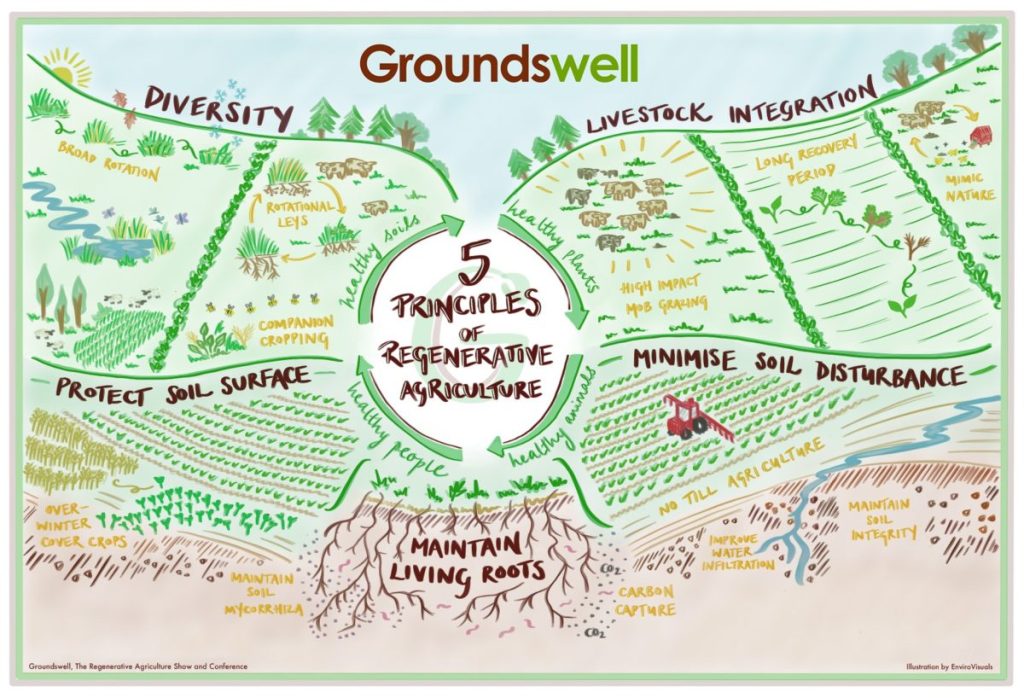
I first met Rona the tame lamb (now sheep*) in the spring of 2020, when Coronavirus restrictions prohibited much contact with humans, and we struck up an acquaintance which has since continued. This reinforced my interest in regenerative sustainability/agriculture and hence the particular resonance of Rebanks’ BBC Radio programme. Wider interest is by no means confined to Britain and I also recently came across a Norwegian initiative called “Amazing Grazing” whose aim is “to bring new knowledge on how sheep rangeland grazing systems can be part of sustainable food and fiber systems.”(13) The project brings together a range of partners from Scandinavia and the United States.(14) David Cutress’ article in Business Wales also highlights North American enthusiasm for RegenAg and draws on research conducted in the Upper Mid West.(10/15) In addition, he asks how this farming model might be better defined in order to avoid potential criticisms of green-washing. The latter is clearly something Groundswell Agriculture are seeking to avoid and their “5 principles” of “soil sense” (Figure 1) are explained in a detailed talk by Karl Ritz, University of Nottingham Emeritus Professor of Soil Ecology.(16)
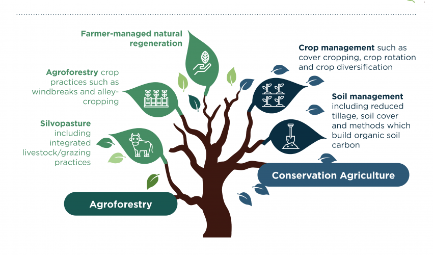
Meanwhile, the IUCN and UNFCCC (United Nations Framework Convention on Climate Change) report on regenerative agriculture in Africa proposes an expanded definition which “encompasses both conservation agriculture and sustainable agroforestry techniques” (see Figure 2 below).(4) The work undertaken with African partners for the COP26 climate conference “provides compelling, quantitative evidence of the positive impacts of regenerative agricultural practices.”
This report presents the case for regenerative agriculture to play a key role within broader land restoration activities and its potential to benefit smallholder farmers, business and society. It demonstrates the benefits of a transition to practices such as agroforestry and soil management as methods to boost yields, improve human nutrition and livelihoods, supporting soil and ecosystem health.
In addition, detailed forecasts up to the year 2040 are provided, by when “through just a 50% adoption of regenerative agriculture across Africa, farmers could see:
30% reduction in soil erosion
Up to a 60% increase in water infiltration rates
24% increase in nitrogen content
20% increase in carbon content, or higher depending on the intervention – and not just topsoil (this is huge as soil is the second biggest storehouse of carbon, after oceans). The benefits are even greater when shrubs and grasses are promoted through agroforestry” (4)
In this scenario, by 2040, “this additional carbon benefit alone could equate to 4.4 GtCO2e (almost 10 times South Africa’s annual emissions). Another 106 MtCO2e per year could be sequestered by restoring degraded land with the inclusion of agroforestry systems”.
Figure 2. (Source IUNC/UNFCCC report on regenerative agriculture in Africa (4))
Returning to James Rebanks’ question of “could I regenerate my farm to save the planet?”(1), the short answer is perhaps this: the global groundswell in regenerative agriculture has considerable potential if its principles and practices reflect key spatial differences in the criteria for sustainable land management. Over developed countries may also have something to learn from less developed ones. Those interested in discovering more about RegenAg and related subjects might subscribe to the 2022 Oxford Real Farming Conference or review the Welsh event’s programme from 2021.(17/18)